+977 9810316180 (Viber & whats App)
Nepal
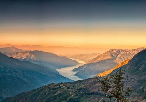
Located in the lap of southern Himalaya, Nepal widged between China in to North and India in to South-West and East. Nepal has enjoyed an independent political existennce from the very earliest time.Nepal has East-West length of 550 miles, North-south width of 120 miles and its western region is expanded more than East and Mid regions. Himalayan region covers 15%, Hill region covers 68% and the Plains cover 17% among the total geography of Nepal. Himalayan region is situated in height ranging from 16000 feet to 29000 feet. From the highest peak Sagarmatha to seven mountains measuring 8000 meters high, all lie in this same Himalayan region. Himalayan region is habituated by Sherpa people popular for mountaineering and they live with their own tradition and culture. Apart from Sherpa people, settlement of other castes like Tamang, Bhote, Jirel, Thami are found.
The hill area exists at the height of 2000 to 16000 meters. Majority of the ethnic groups of Nepal, major culture of Nepal, temples of gods and goddesses, tradition, natural herbs are found in hill region. Here is settlement of people from castes like Magar, Gurung, Brahmin, Chhetri, Dalit, Newar, Baraam, Gharti, Chepang, Kusunda, Raute, Tamang, Rai, Limbu, Sunuwar and others.
Terai or the plains exist at the height of 1000 to 2000 feet from the sea level. It is known as development center of Aryan civilization and academic center of sages from ancient ages. Here people of castes like Tharu, Danuwar, Dhiwar, Meche, Gangaai, Brahmin, Chhetri, Dalit and others have settlement. Tharu is considered to be the oldest ethnic group of Nepali society.
According to the latest census of Nepal, the total population of the country is 30.8 million. Among the total population, 81% of them are Hindu, 17% of them are Buddhist, 1% of them are Muslim and the remaining are Christian, Jain and others. From the ancient times, Nepal is familiar to be common settlement region for Hindu and Buddhist communities. Muslim community which joined during twelfth century has adjusted with Buddhist and Hindu societies and has resided with mutual friendship and brotherhood since then. The cultural practices of Nepal have been found to be developed by Hindu and Buddhist traditions, culture, faith, social values, festivals, arts and architecture. It is difficult to distinguish whether some festivals, temples and shrines are related to Hindu or Buddhist.
The country's natural composition, climate, religion and culture have made Nepali people distinct in terms of appearance and speech. Consequently, the original residents who live in different regions have custom of their own distinct culture, tradition and lifestyle. This way, the geographical condition of the country has become collective source of different castes, culture, appearance and speech.
Though different in terms of appearance, costume and language, the base of folk culture of Nepal is homogenous. The sound of an axe chopping, dried leaves, millstone, wind, river, fountain etc are the sources that different caste people are found to have made songs, and composed music from. Nepali traditional folk culture is an oral history and unwritten alcove of poetry where every society is found to be in misery and happiness. Folk Nepali song is a tone of collective rhythmic poetry from a typical Nepali of rural setting whose emotion is throbbing. Traditional Nepali culture that stays vibrant to many generations conceals stunning Nepali soul.
General information about Nepal:
Nepal, officially the Federal Democratic Republic of Nepal, is a landlocked country in South Asia with a population of 28 million. It is a multiethnic nation with Nepali as the official language. Kathmandu is the nation's capital and largest city
Total Area of Nepal :
147,181 km?2;
Main Religion of Nepal :
Religions practiced in Nepal are: Hinduism, Buddhism, Islam, Christianity, Jainism, Sikhism, Bon, ancestor worship and animism. The majority of Nepalis are either Hindus or Buddhism. The two have co-existed in harmony through centuries. Buddha is widely worshipped by both Buddhists and Hindus of Nepal.
Total Population of Nepal :
Population of Nepal goes up. Nepal ended 2016 with a population of 29,397,789 people, which represents an increasea of 323,457 people compared to 2015. Nepal ranks No. 44 among 184 countries which published this information in countryeconomy.com.
Where is Nepal ?
Nepal lies in between the latitude of 26 0 22’ to 30 0 27’ North and in the longitudinal line between 800 4’ to 88 0 12’ East. The Himalayan Nation Nepal has the stretch of 2200km of Himalayas, hence making this beautiful landlocked country the great Himalayan Nation. Nepal nestles in between two most populous countries; India to East, West and South and China to the North.
What is the average altitude in Nepal?
Nepal's latitude is about the same as that of Florida, however with elevations ranging from less than 100 meters (300 ft) to over 8,000 meters (26,000 ft) and precipitation from 160 millimeters (6 in) to over 5,000 millimeters (16 ft) the country has eight climate zones from tropical to perpetual snow.
International Airport of Nepal
Tribhuvan International Airport is an international airport in Kathmandu, Nepal. The airport is about six kilometres from the city centre, in the Kathmandu valley
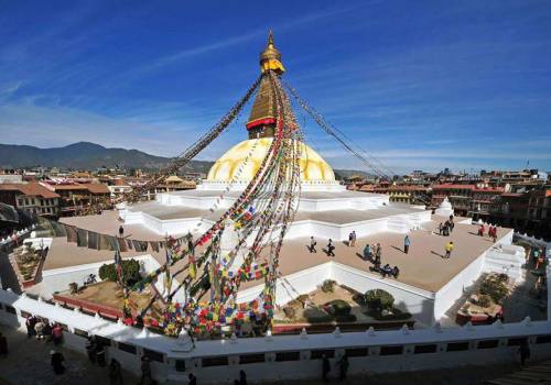
where is kathamndu ? Population of Kathmandu ?
Satellite view is showing Kathmandu, largest city and the national capital of Nepal, situated along the Bagmati River, in central Nepal in the Himalayas at an altitude of 4,450 feet (1,370 m). Kathmandu has a population of about 2.7 million inhabitants in its urban area.
Domestic Airport of Nepal :
S.N. |
Name of Airports |
Located District |
|
1 |
Bhadrapur- Chandragadi |
Jhapa |
|
2 |
Biratnagar |
Morang |
|
3 |
Tumlingtar |
Sankhuwasabha |
|
4 |
Lamidanda |
Khotang |
|
5 |
Manmaya Khanidanda |
Khotang |
|
6 |
Tenjing- Hilari (Lukla) |
Solukhumbu |
|
7 |
Suketar |
Solukhumbu |
|
8 |
Bhojpur |
Bhojpur |
|
9 |
Rajbiraj |
Saptari |
|
10 |
Thamkharka |
Khotang |
|
11 |
Syangboche |
Solukhumbu |
|
12 |
Phaplu |
Solukhumbu |
|
13 |
Kangel |
Solukhumbu |
|
14 |
Rumjatar |
Okhaldunga |
|
15 |
Janakpur |
Dhanusha |
|
16 |
Jiri |
Dolkha |
|
17 |
Ramechhap |
Ramechhap |
|
18 |
Simara |
Bara |
|
19 |
Bharatpur |
Chitwan |
|
20 |
Meghauli |
Chitwan |
|
21 |
Tribhuwan International Airport |
Katamandu |
|
22 |
Pokhara |
Kaski |
|
23 |
Chame |
Manang |
|
24 |
Balewa |
Baglung |
|
25 |
Jomsom |
Mustang |
|
26 |
Rolpa |
Rolpa |
|
27 |
Langtang |
Rasuwa |
|
28 |
Palungtar |
Gorkha |
|
29 |
Gautam Buddha |
Rupandehi |
|
30 |
Dhorpatan |
Baglung |
|
31 |
Tulasipur |
Dang |
|
32 |
Chaurajhari |
Rukum |
|
33 |
Salle |
Rukum |
|
34 |
Rukumkot |
Rukum |
|
35 |
Nepalgunj |
Banke |
|
36 |
Surkhet |
Surkhet |
|
37 |
Juphal |
Dolpa |
|
38 |
Masinechaur |
Dolpa |
|
39 |
Dhangadi |
Kailali |
|
40 |
Tikapur |
Kailali |
|
41 |
Talchha |
Mugu |
|
42 |
Kalikot |
Kalikot |
|
43 |
Silgadi |
Doti |
|
44 |
Simikot |
Humla |
|
45 |
Bajhang |
Bajhang |
|
46 |
Sanfebagar |
Achham |
|
47 |
Kamalbajar |
Achham |
|
48 |
Bajura |
Bajura |
|
49 |
Gokuleswor |
Darchula |
|
50 |
Patan |
Baitadi |
|
51 |
Mahendranagar |
Kanchanpur |
|
52 |
Jumla |
Jumla |
|
53 |
Resunga |
Gulmi |
|
54 |
Phalgunand |
Ilam |
|
55 |
Shitaleswor |
Lamjung |
How to get a visa for Nepal ?
Foreigner, who intends to visit Nepal, must hold valid passport or any travel document equivalent to passport issued by the Govt. for visiting a foreign country prior to apply for visa.
a) Entry: No foreigner can enter and stay in Nepal without valid visa. Nepalese visa can be obtained from Nepalese Embassy or Consulate of the traveler’s country. Traveler’s also can get the visa to Nepal on arrival to Nepal from the immigration section of the entry points.
Popular Entry Points to Nepal:
Kathmandu:Tribhuvan International Airport
borders via land: Birgunj, Sunauli, Kakadvitta, Nepalgunj, Krishnanagar and Pashupatinagar among others
Chinese border via land: Kodari
b) Chinese citizen are requested to apply in Nepalese Embassy or other Nepalese diplomatic missions, as there is no provision of on arrival visa for them.
c) Indian Nationals do not need the visa. However, they need to carry their identification card with photo while traveling to Nepal.
(d) The citizens of SAARC nations do not require Nepalese visa for the first thirty days of their visit to Nepal
www.nepalimmigration.gov.np/
Tourist visa fee for Nepal
1. Visa Fee to visitors who are entering Nepal for the first time in a visa year (Jan-Dec):
US $ 25 or equivalent foreign currency for Tourist Visa with Multiple Entry for 15 days
US $ 40 or equivalent foreign currency for Tourist Visa with Multiple Entry for 30 days
US $ 100 or equivalent foreign currency for Tourist Visa with Multiple Entry for 90 days
Visa Extension Fee:
US $ 2 or equivalent Nepalese currency per day
Additional US $ 20 or equivalent Nepalese currency on visa fee, if Multiple Entry facility is required for the extended period
If foreign visitors that havent renewed their visa want to renew their visa, they have to pay additional Nepalese currency equivalent to US 3$ on the regular visa extension fee.
2. Late fee for regularizing tourist visa:
US$2 in equivalent Nepalese currency per day for the first 30 days
US$3 in equivalent Nepalese currency per day for the next 31 to 90 days
US$5 in equivalent Nepalese currency per day for more than 90 days
3. Free visa for
Children below 10 yrs.
Descendants up to the age of 16 years, holding foreign passports, of Nepalese parents or either of their parent is a Nepalese citizen.
Citizen of Nepali origin, after having obtained passport for the first time from a Nepal based foreign mission, until the period of his departure to a foreign country
www.nepalimmigration.gov.np/
A single-entry visa valid for 15/30/90 days costs US$25/40/100. At Kathmandu's Tribhuvan Airport the fee is payable in any major currency, but at land borders officials require payment in cash US dollars; bring small bills.
what is Nepal famous for ?
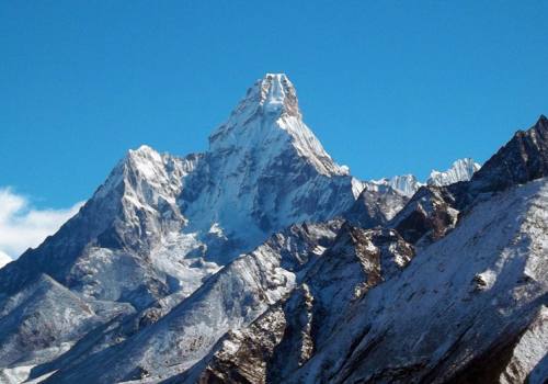
The country of Nepal is famous for being home to the tallest mountain in the world, Mount Everest. Eight of the 14 tallest mountains on the globe lie within the country's borders, including Kanchenjunga, Lhotse, Makalu and Cho Oyu. These mountains make Nepal a haven for professional climbers.
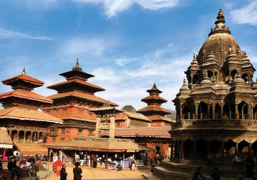
Main City of Nepal : Kathmandu, Bhaktapur, Patan,Pokhara,Biratnagar, Janakpur, Nepalgunj, Butwal, Narayangadh, Dhangadhi,Birgunj
Best Time to Visit Nepal
If you are planning for the Nepal Holidays, first thing you should think is best time. Although Trekking in Nepal can be undertaken all the time in a year but there are few months which are best for hiking through the rugged path. Autumn and Spring season are the best seasons for travel in Nepal. The peak time for trekking in Nepal is from late September to early December when the air is fresh, calm and cool whereas skies clear providing the best views of the mountains. Spring season is the second best time to trek and climbing to Himalayas.
Fall (October-November) is normally dry, stable and very clear, with the most reliable mountain views. (That said, bad weather can strike at any time of year-a disastrous storm in November 1995 brought up to 9 feet of snow in the high country and claimed dozens of trekkers' lives.) Temperatures are moderate, making it a good time for any trek. It can be cold at night higher up, but not as cold as it gets in winter, and the daytime temperatures are pleasantly cool for walking. At low elevations it may still be quite hot during the day, but not as hot as in spring.
However, thanks to the weather, fall is also the most popular season for trekking. You'll hit long lines at the permit offices (especially during the big Dasain festival), guides and porters will charge top dollar, the tourist quarters will be hustley, and all the standard routes-especially Annapurna and Everest-will be maxed. Don't expect solitude.
Winter (December-January) is for the most part dry and settled, albeit colder. How cold depends, of course, on elevation. If you want to go to, say, Everest Base Camp (at about 17,000 feet) you'll have to be prepared for overnight lows of -10° to -20°F; high passes at this time of year are icy and will probably require crampons and some technical experience. But if you're not into winter conditions, just stay lower: since Nepal is about as far south as central Florida, the lower hills will still be surprisingly springlike-below about 6,000 feet you won't even see frost. The trails are relatively quiet in winter, but note that many teahouses may be closed, especially higher up. The days are shorter, too.
Temperatures and the snow line rise steadily during spring (February to about mid-April), while the likelihood of precipitation increases. The warmer weather brings more trekkers, though not as many as in autumn. The main factor that keeps the numbers down is a disappointing haze that creeps up in elevation during this period. By April, you probably won't get good views until you reach 12,000 feet or so. However, the rhododendrons are spectacular in April at about 6-8,000 feet.
It gets that much hotter, hazier and unsettled in May and early June. The warming Asian landmass has begun drawing air up from the south, ushering in the pre-monsoon-a period of erratic afternoon clouds and occasional squalls as hot, dry air from India is forced up over the mountains. The trails and teahouses again begin to empty out. This is a time for going high, but be prepared for rain, especially in traditionally wet areas such as Annapurna.
The monsoon proper begins when the warm, moist air from the Indian Ocean arrives. The rains generally advance from east to west in early to mid-June. They build to a peak in July and early August, then taper off again until clear weather returns by early October. Even at the monsoon's height, however, it doesn't bring continuous torrential rain-torrential, and sometimes you'll get breaks in the clouds or even patches of blue.
Few foreigners trek during the monsoon because of the rain, mud, leeches, travel difficulties, and general lack of mountain views. The leeches along the mid-elevation trails are not for the squeamish! If you want to stay drier, head for areas in the Himalayan "rain shadow," such as Mustang or Dolpo-or skip Nepal and Tibet.
Places to Visit in Nepal :
Everest Region, Annapurna Region, Manaslu Region, Dolpa and Upper Dolpa, Rara lake, Khaptad and Badimalika Region, Upper Mustang, Lumbini, Janakpur, Kanchanjunga Region, Makalu Region, Langtang region, Kathmandu Valley, Tsum and Nubri Valley etc
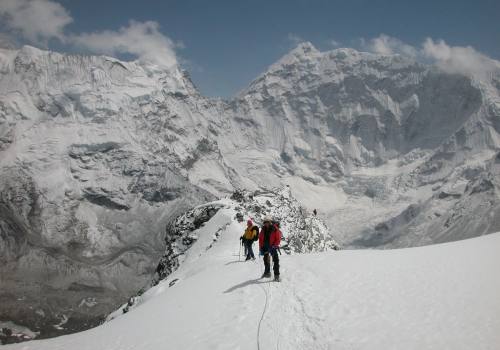
Altitude of base camp of high mountains
Comparing Base Camp Elevations of the 14 Eight-Thousander Peaks
1. Base Camps of Eight-Thousanders Comparative Elevations of the 14 Eight-Thousanders’ Base Camps EVEREST BASE CAMP K2 BASE CAMP KANCHENJUNGA BASE CAMP 5,650 m (18,645’) 5,364 m (17,598’) 5,143 m (16,873’)
2. K2 Base Camp 5,650 m (18,645’) K2 is the 2nd highest mountain in the world and the toughest Eight- Thousander for climbing. K2 BASE CAMP is at the highest elevation of 5,650 m (18,645’). Trek for the base camp starts from Skardu (Balistan). Cross- ing over Baltoro Glacier, one ar- rives at Concordia (Region of Karakoram serving as a junction for the base camps of 4 different Eight-Thousander).
3. Everest Base Camp 5,364 m (17,598’) Everest is the highest mountain in the world. Located at 5,650 m (18,645’), Everest Base Camp is the 2nd most popular destination for trekking in Nepal. Starting from “Hillary-Tenzing Airport” of Lukla, the trek pass- es through numerous Buddhist villages; Namche Bazaar, Pang- boche etc. Kala Patthar 5,550m (18,204ft) is the highest point one can reach during the trek. Everest Base Camp (North)
4. Lhotse 27,940’ (8,516 m), the 4th highest mountain in the world, shares Everest’s base camp. Also, known as Minor Eight-Thou- sander, it is connected to Everest via South Col. It doesn’t has one of its own Base Camp. Lhotse Base Camp 5,364 m (17,598’)
5. 5,143 m (16,873’) Kanchenjunga is known to be the 3rd highest mountain in the world. Located at 5,143 m (16,873’), Kanchenjunga Base Camp lies in the “Restricted Zone.” Passing through Kanchenjunga Conservation Area, Snow Leop- ard and Red Panda are commonly seen during the trek. Pathibhara Temple is another popular des- tination of kanchenjunga Base Camp trek. Kanchenjunga Base Camp
6. Gasherbrum II Base Camp 5,050 m (16,568’) The most attainable Eight-Thou- sander in the Karakoram and an ideal objective for a first 8,000er, Gasherbrum II is located at the border of Pakistan and China. Climbers mainly ascent Gasher- brum II from the southwest ridge (Pakistan), which is considered an easier route compared to the northern ridge of China. Commercial trek to the Base Camp is not known of, however, once can organize the trek and- camp throughout the trail. Climbing Staffs cooking meal during the Climb.
7. Makalu 8,481 m (27,825’) is the 5th highest mountain in the world. It has two notable subsidiary peaks, Kangchuntse and makalu II. The trek passes through Makalu Barun Valley, inside Makalu Na- tional Park, which is rich in natu- ral and cultural wonders. Starting from Tumlingtar, one can enjoy walking through Rhododen- dron forest. Makalu Base Camp 5,000 m (16,404’)
8. Shishapangma Base Camp 5,000 m (16,404’) Shishapangma, also known as “Gosainth?n,” is the 14th highest mountain in the world. The interesting part about Shisha- pangma Base Camp is that one can drive to the location. Try buy- ing the Tour package through an Outdoor ageny in Nepal, for easier visa procession and reasonable cost. Situated solely inside China, al- most 24 climbers have died climb- ing the mountain, up to 2009.
9. Cho Oyu Base Camp 4,900 m (16,076’) #8 Cho Oyu (Tibetan: Turquoise Goddess) is the 6th highest moun- tain in the world. Located at the Khumbu sub-section of Mahalan- gur Himalaya, it stands on Nepal- China border. One needs to enter Tibet be- fore trekking to Cho Oyu Base Camp. Try booking a trek package through an Outdoor agency in Ne- pal. The peak is mainly climbed from the Chinese side. CAMP II at Cho Oyu
10. Dhaulagiri Base Camp 4,750 m (15,584’) #9 Dhaulagiri is the 7th highest mountain in the world. The Ka- ligandaki river flows between through its notable gorge, said to be the world’s deepest. Beginning from beni, the trek crosses “the French Pass” into the hidden Himalaya valley of North- western Nepal. Consider trekking Dhaulagiri du- ing Pre-monsoon and Post-mon- soon seasons.
11. Gasherbrum I Base Camp 4,650 m (15,256’) #10 Gasherbrum I is the 11th highest mountain in the world. Located in the Pakistan-China border, it is a part of Gasherbrum massif in Karakoram Himalaya range. Often claimed to mean “Shining Wall,” trekking to the base camp is tougher due to the lack of com- merical trips. One can trek to the base camp by camping throughout the trail. It is located on a finger of moraine on the Abruzzi Glacier.
12. Broad Peak Base Camp 4,572 m (15,000’) #11 Broad Peak is the 12th highest mountain in the world. Part of Gasherbrum massif on the border of Pakistan-China, Broad Peak is one of the Eight-Thousander locat- ed in Karakoram Himalaya range. Commercial Treks to Broad Peak Base Camp isn’t available, how- ever, one can make an indepen- dent trip to the region and camp throughout the trail. Also known as “K3,” Broad Peak has the highest prominence of 1,701 m (5,581 ft).
13. Nanga Parbat Base Camp 4,500 m (14,763’) #12 Nanga Parbat is the 9th highest mountain in the world. Located in the Gilgit-Balistan region of Paki- stan and farther west of Himalaya, Nanga parbat is known for its notori- ously difficult climb. It was in the Nanga Parbat that Gün- ther Messner (Reinhold Messner’s brother) dies during his maiden climb of Eight-Thousander. Commercial treks to the base camp is available and can be booked from local Outdoor Agencies.
14. Annapurna Base Camp 4,130 m (13,545’) #13 Annapurna Base Camp, 10the high- est mountain in the wold, is the most popular trek destination in the world. More than 70,000 trekkers trek to Annapurna base camp and Circuit in a year. With huge influx of tourists, the re- gion has developed in terms of infra- structure. Many quality Tea-houses, diners etc are available along the trail. It is recommended to trek Annapur- na during Pre-monsoon and Post- monsoon seasons.
15. Manaslu Base Camp 3,800 m (12,467’) Manaslu is the 8th highest mountain in the world. Part of Mansiri Himal in Nepal, it offers various trekking options to the trekkers. One can choose to trek Manaslu Cir- cuit or the Base Camp. The trek starts from Arughat. Many choose trekking the circuit over Base Camp, as the previous is considered more adventurous and involving. It is recommended to trek the region during Pre-monsoon and Post-mon- soon seasons.
Trekking Equipments
While you traveling in Nepal, Tibet and Bhutan for a Trek, mountain climbing trips, tours or biking holidays, the following basic equipment are suggested to carry or arrange for Nepal visitor. Many things you can buy and some of you could rent from Kathmandu and pharaoh as well. But, very strongly suggested Trekking Boots, Medial accessories if you are using special medicine, sunglasses better to take from your home.
What to bring in Nepal for Trekking
Lightweight walking boots. "Walk them in" prior to arrival in Nepal to avoid blisters.
A pair of lightweight/heavyweight trousers are useful higher up in the mountains in the morning and at night.
1-2 pair of loose fitting long shorts/skirts.
2-4 cotton T-shirts.
1 lightweight long sleeved-shirt is particularly suitable for avoiding sun burn.
A sunhat and ensure it has wide brim to cover the face and neck.
2 pairs of thin and 2 pairs of thick woolen socks.
Underwear: normal quantity
Swimming suit
Water Bottle
Sunglasses and strap
Toiletries with large and small towels. Toilet paper can be bought in Kathmandu and some village in the mountains.
Small headlamp and/or flashlight/torch with spare batteries
Personal medical supplies - dont forget band-aids and tweezers.
Army-knife and sewing kit
Sun-screen, sunblock, sun-tan lotion.
Trekking Grade in Nepal :
Pink mountain treks and Expedition graded each trek based on the level of terrain, length of walks, highest elevation and climate. Treks and biking tour graded easy and classic would be suitable for almost anyone having love for adventure.
Treks graded Challenging requires a certain amount of experience and physical health. Our trekking and cycling trips are designed to be accessible to all who are in good health and enjoy the outdoors, but fitness levels are important and you should consider carefully which trip is right for you.
Soft or Easy
Experience is not mandatory for an easy trek in Nepal. Maintained paths and with easy access to modern amenities, easy treks in Nepal have 4- 6 hours each day over steep hilly terrain on usually rough trails but no real extremes of weather. Soft trekking adventures in Nepal reach up to 3500 gaining 400-700 meters every day. Trekkers do not face the fear of high altitude during easy or soft treks in Nepal.
Moderately Challenging
In moderately challenging treks you are likely to walk for 6-7 hrs every day, cross steep hilly terrains to Himalaya base camp in high altitude area over 3500 meter till 5545 meter. These treks come across occasional high passes with daily ascend and descend of around 500-1000m. You are likely to be on a remote environment with extreme weather in some days where you might be facing high altitude air with low level of oxygen and only basic facilities on some nights. Previous trekking experience, physical fitness and positive attitude are therefore essential.
Extremely Challenging
You will be walking for 6-8 hours per day or longer on very high altitude with tough daily ascend and descend of around 500-1000m. Extreme treks also involve remote, wild environment with extreme weather at times and availability of only few facility, perhaps for extended periods. You will also be trekking on minor trails and difficult terrain including snow or scrambling sections. Therefore, trekkers require having high level of physical fitness along with optimal level of experience and positive attitude. It is better to have experience of camping experience on the cold weather.
Trekking Permit in Nepal
A trekker should have a trekking permit issued by Trekking Agencies Association of Nepal (TAAN) or Immigration Department of Nepal to trek in any part of Nepal. TAAN issues permits to trekkers who are trekking to the non-restricted regions of Nepal. The Immigration Department handles the permits required while non- Nepali trekkers trek to the restricted region in the Himalayas. To trek in non-restricted regions of Nepal trekkers need to pay USD 20 for the TIMS Card plus the Conservation Area or National Park Fee. While trekking in the restricted regions the permit fee varies with the region.
For the Annapurna, Everest & Langtang region trekkers requires to have an entrance permit of Annapurna Conservation Area Project (ACAP Permit) Rs 2000, Everest National Park Permit Rs 3000 & Langtang National Park Permit Rs 3000 Rupees along with TIMS Card (Trekking Information Management System) US$ 20 Per person.Trekkers can issue the permit on their own to trek on non-restricted trails.
The following restricted areas are open only for group trekkers and a trekking permit will not be issued to individual trekkers for such areas. The areas and required fees are as follows:
1) Dolpa Region.
A) Area of Lower Dolpo, USD 10 per week per person or equivalent convertible foreign currency
B) Upper Dolpo- For the first 10 days US $500 per person and after 10 days USD 50 per day per person
2) Kanchanjanga Region: Per week per person US$ 10 Or equivalent convertible foreign currency.
3) Upper Mustang Region: For the first 10 days US $500 per person and after 10 days USD 50 per day per person
4) Manaslu Area: Gorkha District from September to November per week per person US$ 70 and after 7 days per day per person US$ 10 and From December to August per week per person US$ 50 and after 7 days per day per person US$ 7 /or equivalent convertible foreign currency
5)Tsum Valley Area: Manaslu Chhekampar and Chumchet VDC - Sirdibas-Lokpa-Chumling-Chhekampar-Nile-Chhule Area- From September to November per person US$35 for first 8 days and from December to August per person US$25 for first 8 days or equivalent convertible foreign currency.
6) Gauri Shankar & Lamabagar Area: Per week per person US$ 10 or equivalent convertible foreign currency
7) Simikot and Yari and Limi Valley Area: For the first 7 days per person US$ 50 and After 7 days per day per person US$ 7 or equivalent convertible foreign currency
8) Thuman and Timure Area: Per week per person US$ 10, or equivalent convertible foreign currency.
9) Makalu Region: For the first 4 weeks per week per person US$ 10 and After 4 weeks per week per person US$ 20, or equivalent convertible foreign currency
10) Areas of Nar, Phu and Northern area of Tilche Village: From September to November per week per person US$ 90 and December to August per week per person US$ 75 or equivalent convertible foreign currency
11) Areas of Mugu, Dolpu, Pulu and Bhangri: For the first 7 days per person US $90 and After 7 days per day per person US$15 or equivalent convertible foreign currency
12) Areas of Kanda, Saipal, Dhuli: For the first 7 days per person US $90 and After 7 days per day per person US$15 or equivalent convertible foreign currency
13) Darchula District: Areas of Byas Village Development Committee: For the first 7 days per person US $90 and After 7 days per day per person US$15 or equivalent convertible foreign currency
Trekking Clothes for Nepal :
Warm jacket. Fiberfill or down should be adequate. This is especially necessary during winter from December to February.
Sleeping bag to -15 C or sleep sheet (if renting or agency supplied)
Woolen shirts and thick sweaters. During winter months, December through February, These items are essential. Thick sweaters can be purchased in Kathmandu.
Windproof/Waterproof trousers. Necessity on all treks going above 3,000 meters.
Thermal underwear. These are excellent to sleep in at night. In the winter months thermal underwear are quite invaluable.
A woolen hat to wear in the morning and at night. During winter it is an essential item.
A pair of gloves. Leather with lining and woolen are best.
Snow Glasses and strap
Snow gaiters can be essential
Altitude Sickness in Nepal
The Mountain Altitude sickness- to know about the safety measures to avoid AMS and to understand the basic medical treatments once AMS hits you are most important things for you before trekking in Nepal. The Acute Mountain Sickness is an illness caused due to gain in elevation. Compared to sea level the amount of oxygen in higher altitude is less and the oxygen level goes thinner as trekkers continue to gain higher altitude. Here Pink Mountain Treks and Expedition have listed the details of AMS please have a look.
Symptoms of AMS
The symptoms of AMS are can be several. They vary from person to person. However, general symptoms of AMS are as follows. If you are seen with, any of these symptoms do not delay to identify the illness and go for the quick treatment ASAP.
Difficulty sleeping
Dizziness or light-headedness
Fatigue
Headache
Loss of appetite
Nausea or vomiting
(heart rate) Rapid pulse
with exertion Shortness of breath
Severe cases of AMS may lead you to HAPE (High Altitude Pulmonary Edema) or HACE (High Altitude Cerebral Edema). HAPE hits your respiratory system where as HACE hits your Nervous System.
Symptoms that may occur with more severe acute mountain sickness include:
Blue color to the skin (cyanosis)
Chest tightness or congestion
Consufion
Cough
Coughing up blood
Withdrawal from social interaction
Gray or pale complexion
Cannot walk in a straight line, or walk at all
Shortness of breath at rest
Related Oxygen Rate at Different Altitude
Altitude Oxygen Rate
In Meters In Feet
8.850 29.035 33%
8.000 26.247 36%
7.000 22.966 41%
6.000 19.865 47%
5.500 18.045 50%
5.200 17.061 52%
5.000 16.404 53%
4.500 14.764 57%
4.000 13.123 60%
3.500 11.483 64%
3.000 9.843 68%
Sea Level 100%
Facts on HAPE & HACE
HACE or HAPE occur in approximately 1 to 2% of people going to high altitude
HAPE and HACE may occur alone or together
HAPE is roughly twice as common as HACE
HAPE causes many more deaths than HACE
HAPE may appear without any preceding symptoms of AMS
HAPE is more likely in people with colds or chest infections
HAPE often comes on after the second night spent at a higher altitude
HAPE can develop even after descending from a higher altitude
HACE usually develops after symptoms of AMS have appeared and often gets rapidly worse during the night
HACE may develop in the later stages of HAPE
HACE (High Altitude Cerebral Edema)
HACE is caused by an accumulation of fluid in or around the brain. Typically, symptoms and signs of AMS become worse and HACE develops. Someone with HAPE may also develop HACE.
Symptoms & signs
Severe headache, which often feels worse on lying down and is not relieved by ibuprofen, paracetamol or aspirin
Tiredness, severe fatigue
Nausea and or vomiting which may be severe and persistent
Loss of coordination, clumsiness. The victim needs help with simple tasks such as tying their shoelaces or packing their bag. They cannot do the finger-nose test
Staggering, falling. They cannot do the heel to toe walking test or the standing test
Blurred or double vision, seeing halos around objects
Loss of mental abilities such as memory. They cannot do a simple mental arithmetic test
Confusion, hallucinations
Change in behavior (aggression, apathy, etc.)
Drowsiness, difficult to wake up, coma, death
Tests for HACE
Heel-to-toe walking test: The victim is asked to take 10 very small steps, placing the heel of one foot to the toes of the other foot as they go. Reasonably flat ground is necessary and the victim should not be helped
Standing test: The victim stands with eyes closed, feet together and arms by their sides
Finger-nose test: With eyes closed, the victim repeatedly and rapidly alternates between touching the tip of their nose with an index finger then extending this arm to point into the distance (a useful test if the victim is in a sleeping bag)
Mental arithmetic test: Give the victim a mental arithmetic test, eg. subtract 7 from 100, 7 from 93, and so on (but remember some people may be poor at arithmetic even at sea level)
If the victim cannot do any of the above tests easily (or refuses to cooperate), or show excess wobbling or falling over in the two first tests (be prepared to catch the victim if they fall over!), assume they are suffering from HACE. If in doubt about the victim performance, compare with a healthy individual. Be prepared to keep repeating these tests.
Treatment
Descend immediately (prompt descent will begin to reverse the symptoms). Descend as low as possible, at least 1000m /3280 ft. Descend at night or in bad weather if necessary. Carry the victim if possible, as the exertion of walking can make the illness worse
If descent is not immediately possible (eg. dangerous terrain or weather, not enough helpers or while waiting for a helicopter), oxygen or the use of a PAC and appropriate medications will keep the person alive until descent can be undertaken
Give oxygen:
From a bottle using a mask (2 to 4 L/min)
By using a pressure bag (this is roughly the equivalent of 2 to 4 L of oxygen/min)
NB: If both oxygen and a pressure bag are available, give the oxygen while the bag is being prepared and after the victim comes out of the bag. Do not give oxygen inside the bag unless it is designed for this purpose and you have been trained to do so.
Give medications:
8 mg of dexamethasone at once (by mouth, IV or IM) followed by 4 mg 6-hourly. Dexamethasone takes several hours to work. Stop it once below 2500m/8200ft AND after at least 3 days of treatment by tailing off the dose slowly (give the last 3 doses 12-hourly)
Diamox 250 mg 8 to12-hourly
Treat persistent vomiting with anti-vomiting medication
Prop the victim up in a semi reclining position as lying down flat may make their condition worse
Avoid even the slightest exertion if this is possible. Even walking a few steps may make their symptoms worse or reappear. Do not leave the victim alone.
If a person is turning blue or is falling into unconsciousness, give them rescue breathing before they stop breathing
HAPE (High Altitude Pulmonary Edema)
Symptoms of HAPE are due to the accumulation of fluid in or around the lungs. It may appear on its own without any preceding symptoms of AMS (this happens in about 50% of cases), or it may develop at the same time as AMS. HAPE can easily be mistaken for a chest infection or asthma: if in doubt treat for both.
Symptoms & signs
A reduction in physical performance (tiredness, severe fatigue) and a dry cough are often the earliest signs that HAPE is developing breathlessness.
In the early stages of HAPE, this may mean just taking a bit longer to get one breath back on resting after mild exercise. Later on, there is marked breathlessness with mild exercise. Finally, breathlessness occurs at rest. Record the respiratory rate (NB: At 6000m/19700ft, acclimatized respiration rate is up to 20 breaths per minute)
The dry cough may later become wet with frothy sputum, which may be bloodstained (pink or rust colored). This is a serious sign
Wet sounds in the lungs when breathing in deeply (place your ear on the bare skin of the victim back below the shoulder blades; compare with a healthy person).
Note: There may be NO wet sounds in even quite severe HAPE: this is called dry HAPE.
There may be: mild fever up to 38.5ºC, a sense of inner cold, pains in the chest
Blueness or darkness of face, lips, tongue or nails due to lack of oxygen in the blood (cyanosis)
Drowsiness, difficulty waking up, coma, death
Treatment
Same general treatment as for HACE, EXCEPT: Use oxygen or the PAC and appropriate medications will keep the person alive until descent can be undertaken
Give Medications:
Nifedipine. This should only be used if bottled oxygen or a pressure chamber is not available and the victim is warm and well hydrated. Give the modified release (MR) form of the tablets (20 mg 12-hourly for 2 or 3 days). If a fall in blood pressure occurs due to nifedipine (pallor, weak rapid pulse, dizzy on standing), treat as shock
Diamox 250 mg 8 to 12-hourly
An asthma reliever spray (2 puffs 4-hourly) may help
Trekking Guide in Nepal
You will be provide Trekking Guide for Trekking in Nepal by Trekking agency like Pink Mountain.If you want to Hire a Trekking guide, please write us at : [email protected]
Tour Guide in Nepal
You will be provide Tour Guide for Tour in Nepal by Professional agency like Pink Mountain.If you want to Hire a Tour guide, please write us at : [email protected]
Cost for Trekking in Nepal
It depend on How many days and whcih region Trek will you choose.
Cheap Trekking in Nepal
For Cheap Trekking in any destination of Nepal, please write us at [email protected]
Cheap Tours in Nepal :
For Cheap Tour in any destination of Nepal, please write us at [email protected]
Best Short Treks in Nepal :
Poon Hill Ghorepani/Chisapani Nagarkot/Pandrung Village Bahakot Danda
Top and best Treks in Nepal :
Everest Region Trek/Annapurna Region Trek/Manaslu Region Trek/Langtang Region Trek
Seven Best Tours in Nepal :
Kathmandu Excursion Tour
Nepal Festival Tour
Kathmandu Pokhara Lumbini Chitwan Tour
Sinja Valley Jumla Tour
Terai Excursion
Cultural Tour
Historical Tour
What is famous in Nepal ?
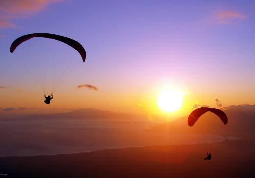
Mountain/Trekking/Climbing/Jungle Safari/Paragliding/Mountain Flight
Is Nepal a hindu Country ?
Officially not
Some Important information to tourist: Dont or Dos
A tourist may stay in Nepal up to 150 days in a visa year (Jan-Dec).
A tourist must extend his/her visa before expiry of the visa validity period.
A tourist who does not comply with these regulations may be liable of fine and other prosecution as provided in Immigration Act and Rules.
A Foreigner having obtained tourist visa shall not allowed to work with or without receiving remuneration.
A foreigner shall not be allowed to carry out any work other than that for which purpose s/he has obtained the visa.
Bus Ticket in Nepal:
For bus ticket in any destination of Nepal, please fell free to write us at [email protected]
Air Ticket in Nepal :
For inbound and outbound air ticket to any destination of Nepal and world, please fell free to write us at [email protected]